Unlock the Mysteries of Navigation: Learn How to Read a Map
Great! Let’s start with the basics of reading a map.
A map is a representation of an area of land or sea, showing physical features, cities, roads, and other information. It is a two-dimensional image that is drawn to scale, meaning that the distances and sizes of objects on the map are proportional to the actual distances and sizes on the ground.
There are different types of maps, such as topographical maps, road maps, and weather maps. Each type of map has its unique features and symbols.
The first step in reading a map is to understand the key or legend. The key or legend is a guide that explains the symbols and features on the map. It is usually located in one corner of the map and is represented by a box with symbols and their meanings.
Once you understand the key or legend, you can start to read the map. The most important information on a map is its scale. The scale is the ratio of the distance on the map to the actual distance on the ground. For example, a map with a scale of 1:10,000 means that one unit of distance on the map represents 10,000 units of distance on the ground.
To determine the distance between two points on a map, you need to use a ruler or a string to measure the distance on the map and then multiply it by the scale to get the actual distance on the ground.
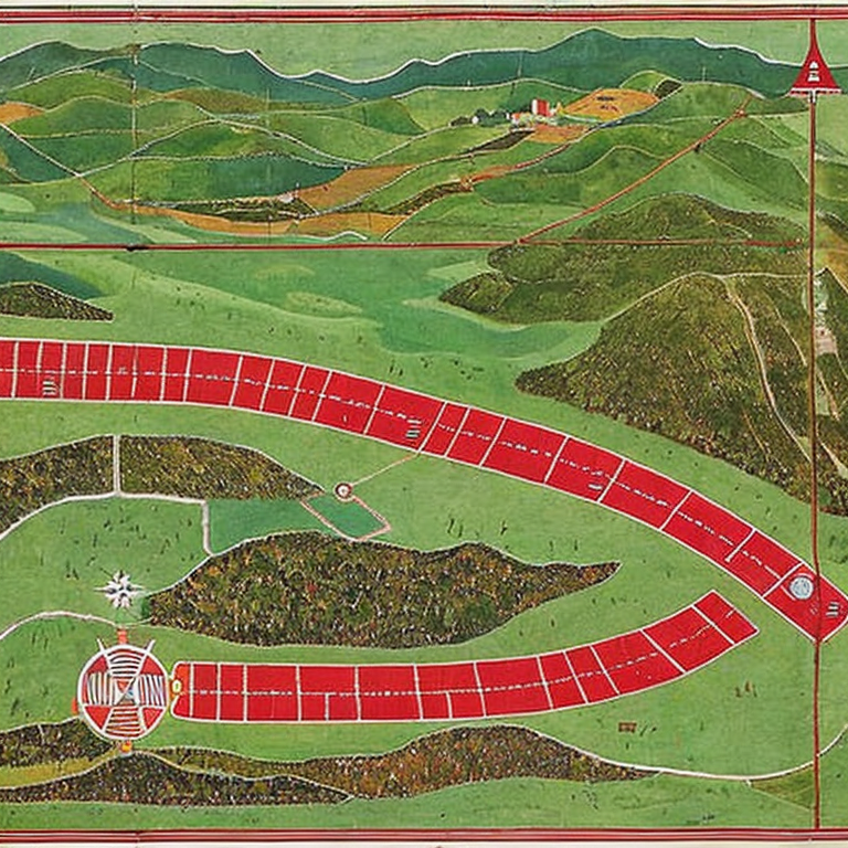
Another important feature on a map is the compass rose. The compass rose shows the four cardinal directions: north, south, east, and west. It helps you orient yourself and determine which direction you are facing.
Physical features such as mountains, rivers, and lakes are usually indicated on a map using contour lines. Contour lines are lines that connect points of equal elevation. They show the shape and elevation of the land.
Roads, highways, and other transportation routes are shown using different symbols and colors. They are usually labeled with numbers and names.
Cities, towns, and other landmarks are shown using symbols such as dots, squares, and triangles. They are usually labeled with names and other important information such as population and elevation.
In conclusion, reading a map is an essential skill that can help you navigate and explore the world around you. By understanding the key or legend, scale, compass rose, contour lines, and other symbols, you can read and interpret maps with confidence. Remember to always carry a map and compass when exploring new areas, and have fun exploring!
Lost in Translation: The Top Map Reading Mishaps
When reading a map, there are several common and uncommon issues that one may encounter. Here are some of them and tips on how to solve or avoid them:
1. Difficulty in interpreting symbols: Maps use symbols to represent various features such as roads, water bodies, and buildings. However, some symbols may not be easy to interpret, especially for beginners. One solution is to refer to the map’s legend or key, which explains what each symbol means. It may also be helpful to practice reading maps regularly to become familiar with the symbols.
2. Misreading the scale: The scale on a map shows the relationship between the map’s representation and the actual size of the features being mapped. Misreading the scale can result in incorrect distance measurements or difficulty in determining the size of an area. To avoid this, always check the scale before making any measurements or calculations.
3. Inaccurate compass bearings: Compass bearings are used to determine the direction of travel. However, inaccuracies may occur due to magnetic declination or errors in reading the compass. To avoid this, use a compass that has been calibrated for the specific location and always double-check the readings.
4. Poor lighting or visibility: weather conditions, time of day, and other factors can affect visibility when reading a map. To improve visibility, use a flashlight or headlamp when reading a map in low-light conditions. In foggy or hazy conditions, it may be helpful to use a compass or GPS to navigate.
5. Missing or outdated information: Maps may not always include the most up-to-date information, and some features may be missing. To ensure accuracy, always use the most recent edition of the map and cross-check with other sources of information such as GPS or local guides.
6. Unfamiliar terrain: It can be challenging to read a map in unfamiliar terrain. To prepare for this, study the map before setting out on the Journey, and plan the route carefully. It may also be helpful to use a GPS or hire a local guide.
In conclusion, reading a map can be challenging, but with practice, anyone can become proficient. Always use the most recent edition of the map, double-check compass bearings, and refer to the legend or key to interpret symbols. By following these tips, you can avoid common and uncommon issues and navigate with confidence.
Master the Art of Navigation: Advanced Map Reading Tips
Great question! For advanced users who are already proficient in reading maps, there are a variety of exciting projects that can be tackled. Here are a few ideas:
1. Create a custom map: If you have specific data or information that you want to display on a map, you can create a custom map using tools like Google Maps or ArcGIS. This can be a great way to visualize information and create a more engaging way to present it.
2. Conduct a geographic analysis: Maps are a powerful tool for analyzing geographic data. Advanced users can use GIS (geographic information system) software to conduct detailed geographic analyses. For example, you could analyze how different demographic groups are distributed across a city, or how different land uses are distributed across a region.
3. Map a historical event: Maps can be a great way to explore and visualize historical events. For example, you could create a map showing the route of Lewis and Clark’s expedition, or map the Battle of Gettysburg.
4. Create a 3D map: While most maps are 2D, it is possible to create 3D maps using software like Google Earth. This can be a great way to explore and visualize terrain and topography.
5. Map a personal journey: If you have a particular journey or trip that you would like to document, you could create a personal map showing the route you took, the places you visited, and any interesting information about those places.
My advice for advanced users would be to continue exploring new tools and techniques for working with maps. There are always new technologies and approaches emerging, so it’s important to stay up-to-date and continue learning. Additionally, consider collaborating with others who have expertise in different areas, such as data analysis or graphic design, to create more powerful and engaging maps.
Tags: adventure, cartography, compass, coordinates, directions, Exploration, geography, GPS, hiking, landmarks, map, navigation, orientation, outdoor, reading, routeplanning, topography, tourism, travel
Tweet